View of Amsterdam
- Medium
- Woodcut with letterpress
- Dimensions
- 42 × 43 in. (106.68 × 109.22 cm) (overall, approx., if joined)
- Genre
Tags
netherlands
About
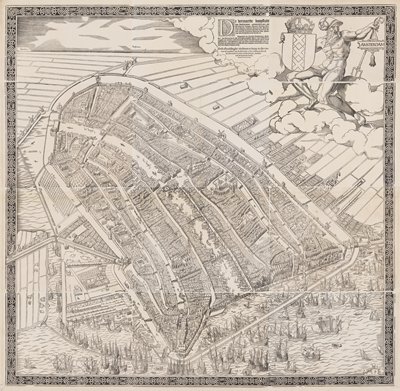
This woodcut is the first printed map of Amsterdam. The panorama is taken from an imaginary viewpoint high above the harbor. The foreground features the brisk maritime activity that sparked the city’s growth. This image proved so popular that the twelve carved wooden blocks used to produce it were reused to produce multiple editions over the course of more than 100 years. This example was printed about 1590. Though hundreds—if not thousands—were printed, it seems that less than twenty survive today.